
Accessible Route of the Week: Larkspur
New routes highlighted weekly.
by Hayley McClure
OAS Staff
While social distancing precautions are in order, it is still so very important that everyone has access to getting outside and staying active for our mental and physical health. In this Thrive Guide series, we hope to support your recreation goals by featuring some accessible urban routes around Bend that remain open, so that everyone can find rejuvenation in exercise, fresh air, and nature! Over the next few weeks, try a new trail and don’t get stuck doing the same ol’ loop over and over and over and over…
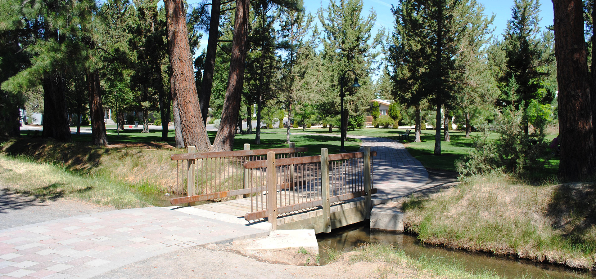
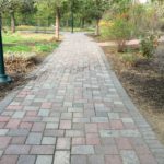
Photo courtesy of Bend Parks and Rec.
OAS ROUTE OF THE WEEK
South Larkspur Trail – From Larkspur Park to Neff Road
LOCATION
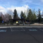
The South Larkspur trailhead is accessed from Larkspur Park which shares a parking area with the Bend Senior Center. It is located at 1600 Southeast Reed Market Road, Bend, OR 97702
PARKING
There are 5 ADA parking spaces available at Larkspur Park.
AMENITIES @ Larkspur Park
- Parking includes ADA parking
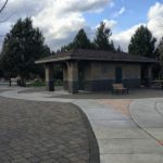
- ADA Restrooms: 3 total, 2 year round
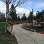
- Picnic areas adjacent to restrooms and playground, with eight ADA tables
- Play structure (currently closed due to Social Distancing orders)
- Accessible nature viewing lookout.
PUBLIC TRANSPORTATION
Cascades East Transit offers two routes, Route 5 and Route 6, that frequent The Bend Senior Center, located on the same site as Larkspur Park, approx. once per hour. Both Bus routes/lines begin departures from the Hawthorne Center at 6am, and final departures at 7pm. Visit Cascades East Transit’s website for route schedules and trip planning. Note: Due to Covid 19, route restrictions, riding precautions, and alternative schedules may apply. Make sure to double check their website before venturing out.
TRAIL MAP
For supplemental information, check out park, path, and map information from the Bend Parks and Rec’s website.
FACILITY CONTACT INFO
- District office (during business hours) – (541) 389-7275
- Juniper Swim and Fitness (after business hours) – (541) 389-7665
- Park Services (for maintenance notifications) – (541) 388-5435
TRAIL DESCRIPTION
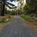
This is a great trail for running, walking, and leisurely bike rides. The trail begins at Larkspur Park adjacent to the Bend Senior Center. To begin, follow the brick path north to the trailhead sign, continue right on the gravel path to begin your journey! The first half of Larkspur Trail meanders along an old canal, through the Pinewood Natural Area, and in between residential neighborhoods. This urban nature trail is forested with towering ponderosa pines and juniper trees. At 1.1 miles, the gravel section ends at Bear Creek Rd. Continue Left on the paved sidewalk to the roundabout and follow the crosswalk, right toward Pilot Butte to pick up the off road paved path again. The route will take you through a tunnel to underpass Hwy 20, and connect you with Pilot Butte State Park (facilities currently closed). From the base of Pilot Butte, continue north on the paved path through sagebrush and juniper. Don’t forget to look east for a panoramic view of Central, OR’s high desert hills! This section of trail ends at Neff road, which is a good stopping point and recommended turn around spot. The path beyond is less maintained with very steep terrain. Enjoy the downhill back.
TRAIL RATING
Moderate. The trail is relatively flat, smooth, and unobstructed by obstacles, however there are places of higher grades, longer, rolling slopes, and a section of rutted pavement. Persons using a mobility device may require assistance when navigating through these select areas. There are also no distinct edge markers along the canal through the gravel section. From south to north, terrain begins flat and becomes more sloped as you approach Pilot Butte, beginning at the underpass. Longer hills with grades between approx. 6% and 8% occur in the Pilot Butte State Park area.
TRAIL ELEMENTS
- Surface: Combination of brick (Park grounds), packed gravel, and pavement
- Width: Width of trail varies between 6ft and 9ft
- Grade: partially flat with some longer climbs. Slopes up to 11% grade in some places. Longer climbs approx 8-9% grade
- Cross Slope: Mostly even with some cross slopes up to 8%
ROUTE OPTIONS + DISTANCES
- From Larkspur Park to Neff Road: Approx. 3 miles, 6 miles out and back.
- From Larkspur Park to Bear Creek Rd: Approx. 1.1 miles, 2.2 miles out and back
- Obstacles: No distinct edges between gravel path and old canal, or path and steeper property lines. A couple non- ADA compliant street ramps. Transition from gravel to pavement crossing over metal ground plate. Large cracks in path at the base of Pilot Butte up to 5 inches wide.
ITEMS TO NOTE
Larkspur trail can also be accessed at Pilot Butte State Park, however, this area is currently closed due to state park closures, including restrooms. Use restrooms at Larkspur park before starting your hike.
AREA PHOTOS


ADDITIONAL ROUTES on the Thrive Guide
Tumalo Creek Trail @ Shevlin Park
Thanks to the work of Access Recreation, based in Portland OR, we’ve adopted their guidelines to describe our suggested routes, so that you have the information you need to make an informed decision. To learn more about Access Recreation and accessible trails in the Portland area, click HERE!
Disclaimer: Please practice social distancing while out on trails and paths. Please note, this content was designed for informational purposes and to help you determine if this route is best for you. Please, USE THIS INFORMATION AT YOUR OWN RISK. You are responsible for your own safety and knowing your own fitness levels. Oregon Adaptive Sports is not liable for any injuries as a result of visiting and using these suggested routes.