
Accessible Route of the Week: Rockridge Park
New routes highlighted weekly.
by Hayley McClure
OAS Staff
If you’re a High Desert Spring enthusiast like me, and on the lookout to catch a few native wildflowers while they’re still in bloom, now is the time to check out Rockridge Park! I ventured out to visit this park for the first time, and am thrilled to share this gem on the north side of town. This playful park offers a variety of recreation opportunities, including accessible routes that ramble through an old growth juniper and sagebrush landscape. With options of a paved or gravel loop, this is a seek-your-own adventure stroll in the park, and a new favorite on my list.
OAS ROUTE OF THE WEEK
Rockridge Park Loop
FACILITY AND LOCATION
Rockridge Park sits on the NE side of town, across the way from Lava Ridge Elementary and Sky View Middle School. The park features an array of activities including paved and unpaved trails, skate park, disc golf course, natural play area, bike skills course, and large open green spaces for recreating and picnicking. It is located at 20885 Egypt Dr, Bend, OR 9770.
PARKING
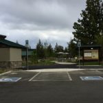
There are 2 ADA parking spaces at Rockridge Park
AMENITIES @ LARKSPUR PARK
- ADA Parking at main entrance, 2
- Portable ADA restrooms at main and south entrance, 1 at each
- Seasonal permanent restrooms, 2 – currently closed
- Seasonal water fountains at main and south entrance, currently shut off
- Benches every 100 meters along paved trail
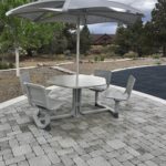
- ADA picnic tables at main entrance and South entrance: 2 main, 1 south
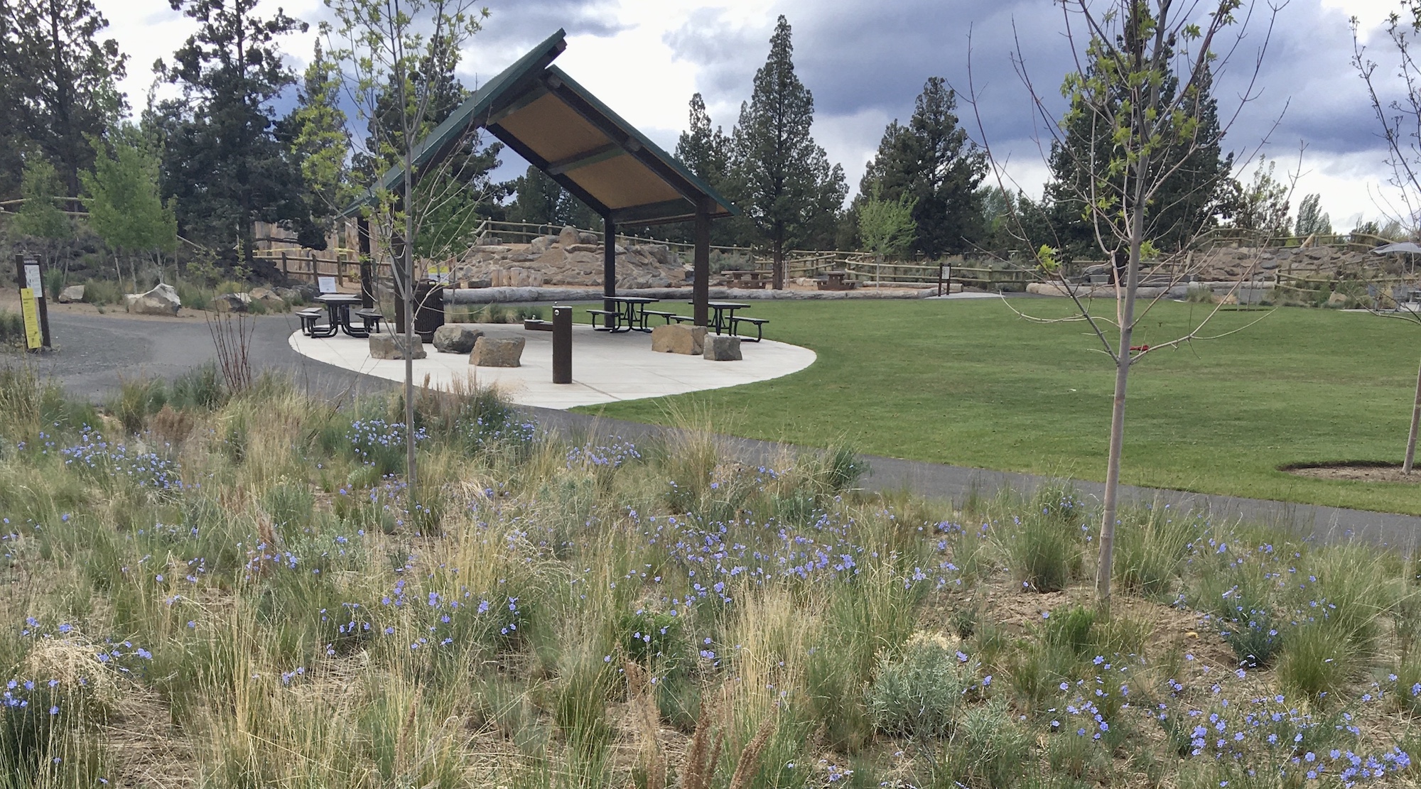
- Large covered structure at main entrance


PUBLIC TRANSPORTATION – Cascades East Transit
Rockridge Park is not located on a regularly scheduled CET bus route, however, you can schedule transportation for your trip with CET’s Ride assist Dial-a-ride to plan your next outing. Follow this link for more information on Dial-a-Ride and scheduling your next outing to locations throughout Bend: https://cascadeseasttransit.com/guide/policies/ride-assist/
TRAIL MAP
A large trail map kiosk is located at the main entrance on Egypt Drive. For more park information, visit Bend Parks and Rec. Rockridge site: https://www.bendparksandrec.org/park/rockridge-park/
FACILITY CONTACT INFO
- Bend Parks and Recreation District office – (541) 389-7275
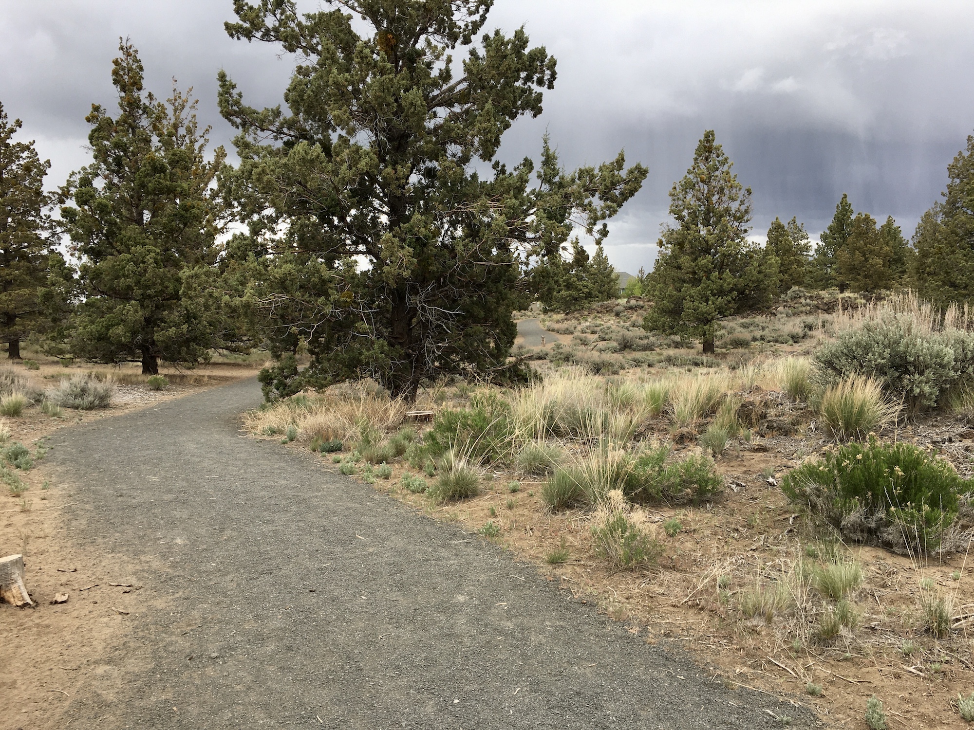
TRAIL DESCRIPTION
A year-round paved loop located within the boundaries of a large community park, featuring a native high desert landscape experience. Beyond the main entrance of the park, a ¾ mile paved path meanders through an old growth juniper and sagebrush landscape. There are two trail loop options for traveling through the park. One paved, one gravel. The paved route extends around the perimeter of the park with opportunities to rest at pathside benches, and a loosely packed gravel route goes a little deeper into the heart of the park. A smaller play structure and turf park at the south entrance mark a halfway point, and opportunity for restrooms and water (when on).
TRAIL OPTIONS AND RATINGS
Paved Loop – Easy to Moderate
This loop is approximately ¾ mile and follows a smooth, wide asphalt path, extending around the perimeter of the park. Pathside benches offer rest areas approximately every 100 meters. This path osculates between flat terrain and a couple longer grades up to 9%. People using a mobility device may need some assistance in these areas.
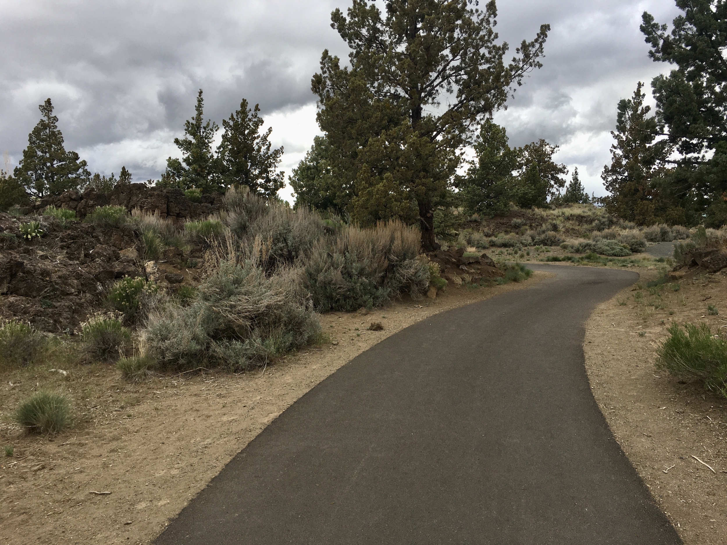
Gravel Loop – Moderate
This loop is a little shorter and offers an intimate view through the center of the park. The wide, gravel path is moderately packed with about a half inch of loose gravel. There are a couple opportunities to rest when the path meets up with the paved route, although it requires a little more traveling across sandy terrain. This path also osculates between level flat areas and grades up to 12%. People using a mobility device may need some assistance in these areas.
TRAIL ELEMENTS
Paved Loop
- Surface: asphalt
- Width: 8 ft, no distinct trail borders. Borders defined by difference in surface material
- Grade: Slight osculating grades, with steeper grades up to 9%
- Cross Slope: Even, flat pavement with less than 2% cross slope
- Distances: Approx. 1 mile from parking area, ¾ mile loop from beginning of trail
- Obstacles: no physical obstructions or breaks in trail along paved loop
Gravel Loop
- Surface: Gravel, approx ½ inch of loose gravel. Some inconsistencies in gravel due to usage
- Width: 9 ft, no distinct trail borders
- Grade: slight osculating grades, with steeper grades up to 12% on one occasion
- Cross Slope: Even, flat gravel trail with less than 2% cross slope
- Distances: Approx. 1 mile from parking area, ½ mile loop from beginning of trail
- Obstacles: gravel is uneven in some areas from high use, and has not been leveled out
ITEMS TO NOTE
- This area is popular for children and teens due to the skate park. I would expect larger crowds at the parking and play areas after school hours, during the summer, and on the weekends.
- Portable restrooms are cleaned regularly, but not pristine.
- Water and permanent restrooms are seasonally closed outside of peak, summer months.
- Access from the south side of the park enters from a residential neighborhood, and does not offer much for parking. Use the main parking area and entrance from Egypt Dr.
- Practice social distancing while out on trails and paths, and follow all rules posted at parks and paths.
ADDITIONAL ROUTES ON THE THRIVE GUIDE
Tumalo Creek Trail @ Shevlin Park
Thanks to the work of Access Recreation, based in Portland OR, we’ve adopted their guidelines to describe our suggested routes, so that you have the information you need to make an informed decision. To learn more about Access Recreation and accessible trails in the Portland area, click HERE!
Disclaimer: Please practice social distancing while out on trails and paths. Please note, this content was designed for informational purposes and to help you determine if this route is best for you. Please, USE THIS INFORMATION AT YOUR OWN RISK. You are responsible for your own safety and knowing your own fitness levels. Oregon Adaptive Sports is not liable for any injuries as a result of visiting and using these suggested routes.